
An interview with Lily Bell, Map Impact’s Chief Technical Officer

Donna Lyndsay, Business Development Director, had the pleasure of interviewing Lily Bell, Map Impact’s Chief Technical Officer, to learn more about her amazing background and her journey to Map Impact. Lily regularly draws on her interdisciplinary experience across academia, NGOs and industry, to bridge science into scalable software. Read the full interview below.

Donna:  Can you tell us a bit about your background and how you came to work and lead in the field of technological advancements in climate intelligence.

Lily:  My personal journey began in academia, where I was initially a cybersecurity researcher, and spent some time doing the same in industry. With an early background in software engineering, I have worked on various projects across my career, including software performance improvement, drone network simulation, and developing alternative models for carbon credit projects invested in by major banks.

Donna:  What led you to transition from academia to Earth observation and sustainability?

Lily: I’ve always been passionate about environmental issues and see earth observation data as a method to make things which are not scalable to measure on a landscape or even global way, measurable. I was a co-founder of the Climate Trace Coalition, which aims to measure greenhouse gas emissions for every industry using satellite data and machine learning. Working alongside a coalition including former US Vice President Al Gore, we built scalable models to understand the impact of greenhouse gas emissions at country and facility level.
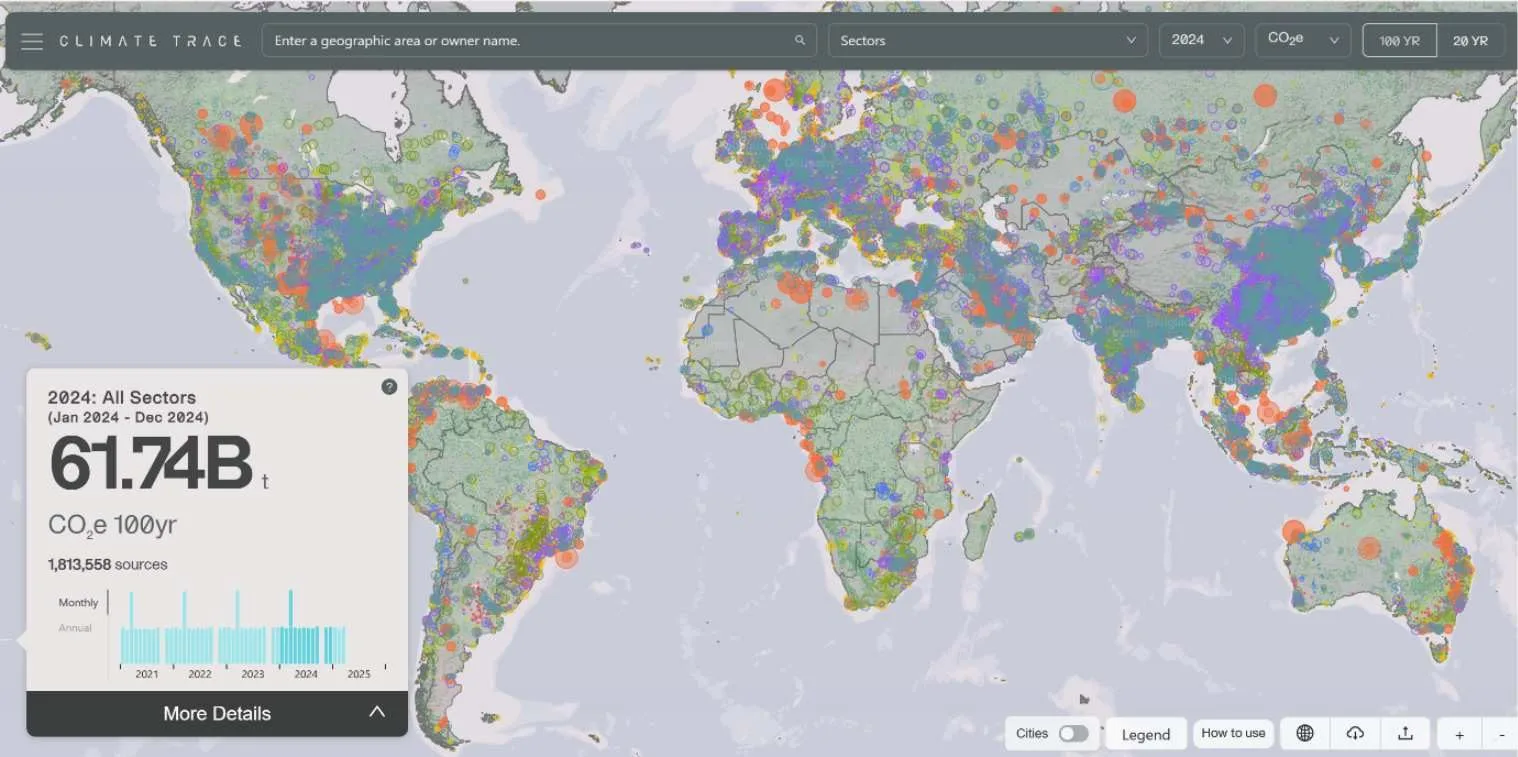
Cllimate Trace.jpg
Lily’s wide-ranging experience includes co-founding the Climate Trace Platform, providing emissions tracking data directly to the public – Copyright Climate Trace.

Donna: Your work with the Climate Trace Coalition sounds impactful. Can you share more about your research at the University of Strathclyde?

Lily: Absolutely. At the University of Strathclyde, my research included involvement in projects simulating drone networks for healthcare delivery here in Scotland and analysis of Green Bond funded avoided deforestation schemes in terms of their wildfire and financial risk. This also gave me an appreciation for the non-financial aspects of nature projects, and the impact they have on local communities, biodiversity and climate risk.

Donna: How has your experience in academia influenced your role at Map Impact?

Lily: It’s been foundational.  As CTO I regularly draw on my interdisciplinary background to bridge science into scalable software. My academic training helps me translate the complexity of the science led work we do into business value through national scale products—making our tools both scientifically rigorous and practical for end-users.

Donna: Lily, as we’re dealing with organisations that need to trust us with delivering large-scale datasets, can you talk about your experience in building robust and secure solutions at scale?

Lily: Absolutely, that’s been a core part of my approach throughout my roles in technology leadership and in academia. My background includes significant hands-on experience architecting and scaling advanced analytics and reporting platforms using the Microsoft cloud ecosystem and delivering API products. Ultimately, I consider security and robust data governance to be not just a compliance need, but an enabler to do business in high trust environments and in critical industries. When organisations know and trust that you take data protection seriously and have a strong risk management culture baked into the architecture of your platform, it opens doors.

Donna: Looking ahead, what is your vision for the future of climate intelligence?

Lily:  I see climate intelligence becoming the connective tissue between science, policy, and finance. As the planet changes, we’ll need smarter, faster, and more transparent data to evaluate the real-world outcomes of climate solutions. I believe Earth observation data will be critical for forecasting the future condition of landscapes and ecosystems and measuring the risk to them in an ever-changing planet. By integrating earth observation data with other environmental and socioeconomic data, we can help de-risk investments, improve regulatory compliance, and accelerate action on nature-based solutions. My focus is on building that infrastructure—so that decision-makers have the foresight and confidence to act boldly.

Donna: Thank you, Lily, for sharing your journey and contributions to climate intelligence. We look forward to seeing your work continue to shape the future at Map Impact.

An interview with Nina Moiseeva, Map Impact’s Chief Scientific Officer

Donna Lyndsay, Business Development Director, had the pleasure of interviewing Nina Moiseeva, Map Impact Chief Scientific Officer, to learn more about her background and her journey to creating Map Impact’s core data products. With a deep passion for data science, earth observation and environmental applications of technology, Nina’s career has seen her supporting sustainable development in regions facing some of the world’s most pressing environmental challenges. Read the full interview below:

Donna: Can you tell us about how your career journey started?

Nina:  My career in geospatial science and Earth observation began at Moscow State University, where I earned my bachelor’s and master’s degrees in cartography and geoinformatics. Back then, AI and ML weren’t as prominent, but studying core GIS and mapping techniques provided a solid foundation for my career.

Donna: What was your first job? 

Nina: While I was still a student, I joined the Institute of Geography at the Academy of Sciences during my second term. I worked on various research projects, mainly focusing on the circumpolar regions and Arctic landscapes, as well as classical cartography, including topographic mapping of my homeland.

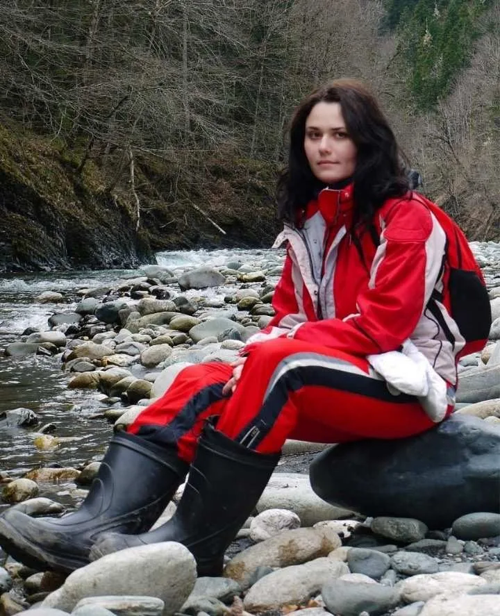
Nina Moiseeva 2.jpg
Nina’s career has taken her on research expeditions to a wide range of landscapes and ecosystems, invoking a passion for applying technology to environmental applications

Donna: Did you have other roles at the beginning of your career? 

Nina: Yes, in my third term, I took a second role, combining my studies with work in academia and a commercial organisation. My first commercial job was as a geospatial engineer for television and mass media, which required rapid map and geo-visualisation production for news, broadcasts and meteorological forecasts, contrasting with the slower and more precise pace of academic research.

Donna: When did you switch to environmental research?

Nina:   I became deeply excited about environmental research once I participated in my first expedition, where I had an opportunity to study the landscape. I then joined a dozen expeditions in various geographic regions and biodiversity zones, collaborating with universities and natural reserves. These expeditions involved field data acquisition, remote sensing techniques, and studying various scientific topics, such as habitat and landscape assessment, Anthropocene and Indigenous populations, palaeogeographical cartography, nature conservation, and mapping of flora and fauna.

Donna: Did you continue your education through your career path?

Nina: Yes. At first, I wanted to understand not only the geospatial technologies but also the economic and environmental aspects of how we use land and resources. So I pursued a master’s degree in Nature Resource Management at Moscow State University’s Department of Public Administration. This helped me combine environmental and economic approaches in areas such as agriculture, forestry, and land management and to understand the human-environmental interaction more deeply. I also earned a degree in Computational Mathematics and Cybernetics. My motivation was to strengthen the algorithmic and computational side of my work.

Donna: What was your next career move? 

Nina: I joined one of the leading oil and gas companies in my country, working as a Geospatial Analyst for environmental assessment during the pipeline and infrastructure construction, as well as exploration and development of oil and gas fields. Understanding and measuring the environmental impact during industrial construction is a vital part of sustainable development.

Donna: What was your previous experience in Earth observation?

Nina:  For almost 10 years, I led a department at Scanex, the leading commercial space company in my home country. This company operates a complete technological cycle, including ground receiving stations of EO data, satellite imagery processing software, analytical projects and products, web portals, and satellite imagery distribution. We developed a wide range of products for forestry, agriculture, environmental disaster monitoring, and marine areas, using both commercial and open Earth observation data.

Donna: What were some of the products you developed? 

Nina: We created various products like Fire Map and Fire Scan for wildfire monitoring and assessment, Marine Portal for maritime, sea and ocean monitoring, SpaceAgro for agriculture, Online Catalogue for the EO data exploration and access, and many others. The company also authored Scanex Image Processor software for the EO technical and thematical processing. These tools and products showcase the diverse applications of geospatial data and Earth observation across various thematic domains and research topics.

Donna: Tell me more about the land use and property assessment projects you worked on.

Nina: I’ve led projects that used satellite, cadastral, and open geospatial data to detect violations of land legislation, including inappropriate land use, which can lead, for example, to soil degradation or reduced renewability of resources. We also worked on identifying high-potential lands for investment, especially for urban development and future housing portfolios.

Donna: How did your UN work come into the picture? 

Nina: I became an individual consultant for the UN in the Asia-Pacific region (UNESCAP), focusing on land cover, wildfire, and drought monitoring, especially in Central Asia. I contributed to projects on country-level wildfire analytics, environmental-economic accounting, and capacity building on the integrated use of GIS and Earth observation for land assessment. This work supported sustainable development in regions facing some of the world’s most pressing environmental challenges.

Donna: And then you moved to the UK?

Nina: Yes, in 2021, I started my studies to receive a Master of Science in Geospatial Science and Computing at UCL. That was a turning point which enabled me to transition into an international career. It also provided me with an opportunity to devote a year to intensive skill development and updates, given the increasingly evolving influence of AI and ML on geospatial science and Earth observation.

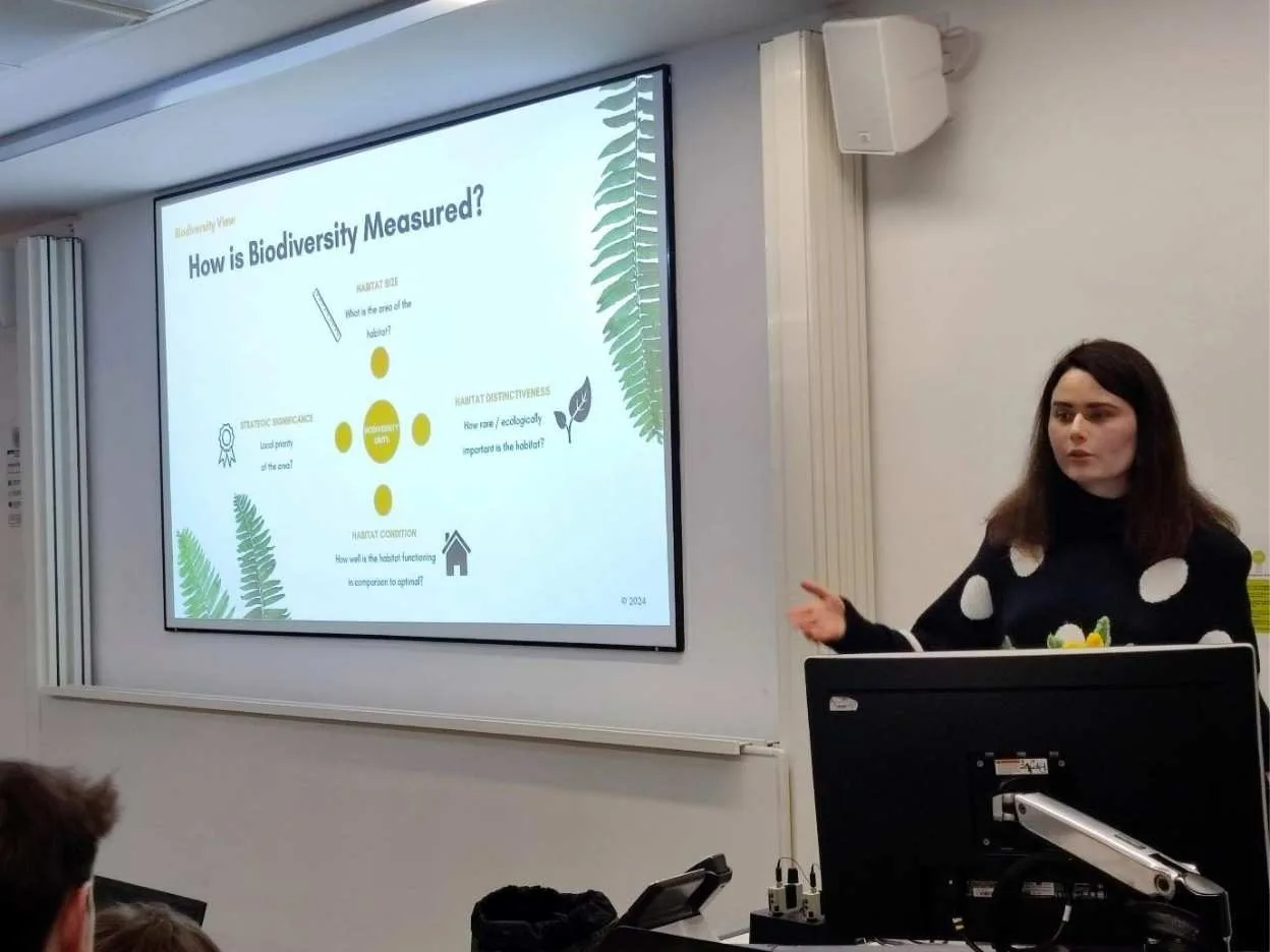
Nina Moiseeva 3.jpg
Nina has a passion for knowledge transfer and training, regularly presenting her work to different audiences

Donna: What are you doing now? 

Nina: I’m lucky to be the Chief Scientific Officer at Map Impact. I joined as an Earth Observation Scientist and have since stepped into the CSO role. I’ve helped to develop our core products: BiodiversityViewHeatViewWildfireView, and DroughtView. I’m responsible for methodologies and workflows for satellite and geospatial data processing, and I’m trying to answer the question of what, how, and why we are computing and analysing. This role allows me to combine all previous experiences across geospatial science, Earth observation, quantitative research, and domain environmental applications.

Donna: Thank you, Nina, for sharing your journey and contributions to climate intelligence. We look forward to seeing your work continue to shape the future at Map Impact.
Biodiversity vs land needs – how do we deliver both, while supporting people, planet and profit?

GeoBusiness Panel session April 2025

Chaired by our Business Development Director, Donna Lyndsay, this panel session was designed to address the land challenge and need through the lens of biodiversity. By bringing together representatives from five different sectors for the first time, we were able to highlight the barriers and issues that were aligning across the sectors.

With discussions with Tim Hopkin, CEO of Land App (representing land owners and farmers), Simon Nigh, Partner & Head of Digital Innovation of Carter Jonas (representing Property Consultants), Kirsty Wilman – COFO Rebalance Earth (Representing Nature-Based solutions and investments), Hannah Cool – COO of B4NZ (representing finance), and Map Impact representing spatial data, we discussed the barriers and issues, and possible solutions to this challenge.

You can listen to the full recording below.

AD 4nXdgq8S6 0RCaJj 3DzenuvA nGY1OXadMoVCIBnNL1 Q9
Left to Right: Kirsty, Simon, Donna, Hannah and Tim at Geobusiness 2025.

Meet the Minds Behind Map Impact: Building the Future of Climate Intelligence

Introduction

At Map Impact, we’re not just building data products, we’re building a new way to understand and respond to climate and environmental risk. Behind our technology is a team of scientists, engineers, and innovators whose diverse expertise powers our mission. In this blog, we introduce three of our senior leaders: Nina Moiseeva, Lily Bell, and Chris Burnett, and explore how their unique journeys and skills are shaping the future of geospatial intelligence.

Nina Moiseeva: Scientific Vision Meets Earth Observation

Chief Scientific Officer, Map Impact

Nina’s career began in classical cartography and geospatial science at Moscow State University. With advanced degrees in natural resource management and computational mathematics, she has worked across academia, industry, and international development, including roles with the United Nations and leading Russian environmental research institutions, as well as commercial space companies.

At Map Impact, Nina leads the scientific design of our climate risk models, including:

  • HeatView – assessing heat stress during a heat wave.
  • WildfireView – Mapping susceptibility to wildfire .
  • DroughtView – monitoring susceptibility during a drought event.

Her approach blends rigorous scientific research with advanced feature engineering and algorithms, transforming satellite data into actionable insights. Nina’s work ensures that every model we build is grounded in ecological reality and scalable for national and global applications.

Lily Bell: Engineering Scalable Climate Intelligence

Chief Technology Officer, Map Impact

Lily brings a rare combination of academic depth and engineering prowess. With a diverse background in academic research, software engineering, and remote sensing, she has worked in both the academic and private sectors, founded the Climate Trace Coalition, and is a leader in applying technology to address global environmental challenges, particularly in biodiversity, nature-based finance, and emissions accounting.

At Map Impact, Lily is the architect of our scalable data infrastructure. She has:

  • Designed national-scale processing pipelines using Google Earth Engine.
  • Built distributed computing environments on Microsoft Azure.
  • Developed parallelized, highly scalable workflows for complex geospatial models.

Her leadership ensures that our products are not only scientifically robust but also engineered for performance, reliability, and real-world impact.

Chris Burnett: From Maps to Market-Ready Products

Chief Product Officer, Map Impact

Chris’s love for Maps began with tracing rivers on his grandfather’s road atlas. With a degree in cartography and a career spanning land surveying, aerial photography, and Earth observation, he has worked on everything from Ordnance Survey updates to marine habitat Mapping in the Middle East.

As co-founder of Map Impact, Chris bridges the gap between data science and user needs. His experience in environmental impact assessment and satellite data delivery ensures that our products are grounded in practical application and designed for decision-makers.

How It All Comes Together

What makes Map Impact unique is the synergy between science, engineering, and product design:

  • Nina defines the scientific workflows and data sets.
  • Lily scales those workflows into national and global products.
  • Chris ensures the outputs meet real-world needs and standards.

Together, they’ve integrated biodiversity data, climate risk models, and computational algorithms into a suite of data products. These products are already helping housing associations, governments, and investors make smarter, more sustainable decisions.

Looking Ahead: Global Scaling and Live Modelling

As Map Impact expands beyond the UK, the team is preparing for new challenges:

  • Distributed computing for global-scale habitat mapping and modelling.
  • Advanced data architectures for location-based information streamline and storage.
  • Scenario-based modelling for live landscape planning and climate resilience.

Our vision is to create a platform where users can simulate interventions such as adding green space or restoring wetlands and instantly see the impact on climate risk.

Conclusion

Map Impact’s strength lies in its people. With deep expertise across science, technology, and environmental systems, our team is redefining what’s possible with Earth observation data. As we scale our products globally, we remain committed to upholding ecological integrity, delivering engineering excellence, and achieving real-world impact

Read Nina’s story

Read Lily’s story

Climate Risk Enters the Conveyancing Process

The upcoming Law Society Practice Note will require conveyancers to conduct environmental searches for newly specified climate change risks—heat stress, water stress and drought, and wildfire. This is a significant step in recognising the growing relevance of climate change to buyers, lenders, and insurers in property transactions.

Here’s why they matter:

1. Heat Stress and Property Vulnerability

  • Urban Heat Islands (UHIs): Properties in urban areas with little green space may experience excessive heat, increasing cooling costs and reducing comfort.
  • Structural Damage: Prolonged heat can affect building materials, leading to cracks in brickwork, asphalt degradation, and even subsidence in certain soils.
  • Health: Extreme heat can make properties less desirable, particularly for vulnerable residents like the elderly or those suffering respiratory issues.

2. Water Stress and Drought Risks

  • Reduced Water Supply: Areas with high water stress may face restrictions, affecting daily life and property values.
  • Soil Shrinkage and Subsidence: Drought can dry out clay-heavy soils, leading to ground movement that causes foundation damage. Subsidence is a major insurance risk.
  • Landcover & Green Spaces: Homes reliant on local water sources for gardens or agriculture may struggle to maintain green spaces, reducing appeal and functionality.

3. Wildfire Risks and Property Safety

  • Increasing UK Wildfire Incidents: Climate change has made wildfires a growing threat, particularly in rural and semi-rural areas.
  • Property Damage: Homes near grasslands, heathlands, or unmanaged woodlands may face rising insurance costs due to higher fire risks.
  • Mortgage & Insurance Concerns: Lenders and insurers may require additional fire mitigation measures or charge higher premiums in high-risk zones.

Why This Matters for Conveyancing

  • Legal Due Diligence: Buyers need to be informed of risks that could affect the long-term viability and safety of a property.
  • Financial Risks: Properties in the very high-risk zones may face higher insurance costs, lower resale values, or mortgage restrictions.
  • Futureproofing: Awareness of these risks helps buyers and investors make informed decisions, ensuring the sustainability and resilience of their property assets.

With climate risks increasing, this Practice Note will ensure conveyancers provide transparent, risk-aware property transactions, safeguarding both buyers and the broader market.

How Land Management Affects Climate Change

As the UK grapples with the growing impacts of climate change – including heat stress, drought, and wildfire risk – the condition of our land habitats, and how we manage them, has never been more critical. Healthy, well-managed landscapes serve as natural buffers against these climate threats, while degraded habitats can exacerbate the problem. Understanding the relationship between habitat condition and climate change risk is key to shaping future policies and pointing conservation efforts towards building resilience.

The Role of Land Habitats in Climate Resilience

Land habitats such as forests, wetlands, grasslands, and urban green spaces play a vital role in regulating local climates, conserving water, and reducing the likelihood of wildfires. However, land degradation, poor management, and habitat loss significantly increase vulnerability to extreme weather events and lead to susceptibility to climate change risks.

Heat Stress and the Importance of Vegetation

One of the most immediate climate risks in the UK is heat stress, particularly in urban areas. Cities and towns with limited green cover suffer from the urban heat island effect, where built-up areas absorb and retain heat during day and night-time hours, leading to significantly higher temperatures compared to surrounding rural areas.

Healthy land habitats, such as woodlands and well-maintained green spaces, provide essential cooling through:

  • Shade from trees reducing surface temperatures.
  • Evapotranspiration, where plants release moisture into the air, helping cool the environment.
  • Soil moisture retention, which moderates temperature fluctuations.

Conversely, deforested areas or poorly maintained urban environments lack these natural cooling mechanisms, increasing the risk of heat-related health issues and energy demand for cooling. Sustained exposure to heat stress also leads to degradation of building materials within property infrastructure.

Drought Susceptibility and Water Stress

The UK has experienced more frequent and severe droughts in recent years, placing strain on water resources and agriculture. The condition of land habitats significantly affects drought resilience:

  • Healthy soils with rich organic content and deep-rooted vegetation improve water retention, slowing down the onset of drought conditions.
  • Wetlands and peatlands act as natural water reservoirs, storing excess rainfall and gradually releasing it during dry periods.
  • Deforestation and land mismanagement lead to rapid water runoff, reducing groundwater storage capability and increasing drought vulnerability.

Efforts to restore wetlands, reforest degraded land, and improve soil health through regenerative farming practices are crucial in mitigating drought and water stress impacts.

Wildfire Risks and Habitat Management

Although traditionally associated with hotter, drier regions, wildfires are an increasing threat in the UK, particularly in heathlands, grasslands, and degraded forests. Poorly managed land can contribute to wildfire risk in several ways:

  • Overgrown, unmanaged vegetation creates excessive fuel loads that intensify fires especially once ‘browned’ following periods of extreme heat.
  • Drained peatlands and dry soils become highly flammable in prolonged dry conditions.
  • Fragmented landscapes limit firebreaks, allowing flames to spread rapidly.
  • Areas of poor habitat condition that border residential and industrial locations present risks of wildfire, with associated dangers to health and property.

Sustainable Land Management

To mitigate climate change risks, policymakers, landowners, and conservationists must prioritise sustainable land management practices. This includes:

  • Expanding and maintaining green infrastructure in urban and rural settings.
  • Restoring degraded landscapes through regeneration and rewilding efforts.
  • Improving soil health via regenerative agriculture and land conservation.
  • Enhancing water management systems to protect against both drought and flooding.

The condition of land habitats is a key determinant of climate resilience. By investing in sustainable land management, we can create a more climate-resilient future, ensuring that both people and nature thrive in a changing world.

At Map Impact we are on a mission to provide meaningful locational climate risk data covering heat stress, drought and wildfire throughout the UK. Our risk assessments consider the nature and condition of surrounding land habitats for every location output.

What is a Local Nature Recovery Strategy (LNRS)?

Local Nature Recovery Strategies (LNRS) are a UK government initiative which aims to identify and prioritise opportunities for improvements to biodiversity across England. 48 LNRS areas have been established in England and a responsible authority assigned to each. These authorities must now produce a report and accompanying map by March 2025. The LNRS should detail the best existing areas for nature and proposals for improving habitats and meeting wider environmental goals in their LNRS area. A pilot programme has already taken place in five of the 48 areas, and this process informed the development of the guidelines issued to the LNRS responsible authorities.

Megan Lindeman expects that the LNRS will be a valuable decision-making tool which will help to guide and inform development, land management, and green finance. “It will give consideration to wider environmental, economic and social benefits and the key part is the first word in it: Local. It will be locally led, it will be evidence-based and it will be collaboratively produced.”

While the purpose of the LNRS is to identify opportunities for nature recovery within the LNRS area, it does not constitute a definitive action plan, nor determine which opportunities will be pursued. Megan explains “We are legally required to prepare an LNRS but we are not, at this stage, required to deliver the priorities and measures that we identify. So, if your area of land appears within the LNRS mapping and is identified as having potential for delivering a particular nature recovery measure it doesn’t mean that you have to do it and it doesn’t mean you cannot continue to use that land for production or forestry or other uses.”

The LNRS comprises of two complementary pieces of work; a map of the existing habitats and a written list identifying opportunities for improvements to and protections for the habitats. An accurate and detailed map is vital to understanding how the opportunities and priorities identified in the report can be enacted in the field. High quality data will be an essential tool for all LNRS areas while they assess which locations and potential improvements to make a priority for action towards nature recovery.

Map Impact’s BiodiversityView provides a unique national dataset of assessed habitat conditions across the whole of England at 50m intervals.  It is ideally suited to provide regional coverage of landscape areas, such as required by LNRS work, or early baseline site assessments required under BNG development planning requirements, where ‘triage, triage, triage’ is the best practice message coming from Natural England and the Planning Advisory Service.

In parts 2 and 3 of this blog series we will discuss the importance of data, and the challenges in delivering and developing a successful LNRS. Local Authority teams are welcome to request a demonstration of BiodiversityView across their own specific area by e-mailing info@mapimpact.io

Six months on from Biodiversity Net Gain

Biodiversity Net Gain (BNG) legislation has been in effect for 6 months. For many stakeholders, including those with an obligation to comply, the concept of BNG and its implementation is new and complex. 

Conversely, the biodiversity duty has been in effect since Section 40 of the Natural Environment and Rural Communities Act in 2006. Local authorities and other stakeholders have each taken different approaches, leading to a lack of synergy before mandatory BNG came into force. 

This has resulted in a fragmented and disconnected readiness since the announcement of BNG in the Environment Act 2021. Access to consistent habitat and biodiversity data is a fundamental obstacle and will be crucial for ensuring compliance over BNG’s 30-year implementation period to achieve the minimum 10% net gain. 

“BNG continues to present challenges to all involved, from ecologists collecting data and carrying out assessment via Local Planning Authority colleagues getting to grips with the new legislation, to habitat bank providers and landowners wrestling with a new regulatory regime. However, all continue to rise to the challenge, and I am pleased to be supporting a number of organisations across this spectrum, all who are working to deliver better outcomes for nature. While it may seem that BNG has started slowly, I know from experience that there is a huge amount of excellent work being carried out, and we will soon start to see the fruits of that work.” Dan Carpenter, Director of Digital Ecology 

Map Impact’s objective and accessible biodiversity dataset is starting to support a wide range of stakeholders as they get to grips with these new requirements and begin to understand the longer-term implications of BNG with regards to monitoring and compliance. This has given us insight into how the new law is landing and where ongoing concerns are being felt across the industry. 

We’ve summarised our view of the current state of play as we see it below:

  1. The revised ‘go live’ dates for BNG, along with the subsequent post-date modifications and additions to BNG policy, revealed that most participants in the process were not fully prepared. Many of them are taking the approach of “doing what we need to” just to meet the minimum compliance standards
  2. There has been no rush by developers to push new applications through the planning process. A change of government, coupled with sustained high interest rates and inflation, has led to a more depressed housing market over the last 18 months.
  3. BNG activity and demand seem to be driven by groups of landowners taking advantage of the opportunity to provide land for BNG credits, supporting an off-site credit market and nature restoration projects. The slow pace of BNG is hindering the response to this growing market.
  4. Local Authorities are hesitant about how to best fulfil their role as regulators and enforcement bodies. They are concerned about the lack of financial and physical resources to support the workflow for BNG planning, as well as for multiple concurrent nature protection and restoration work streams.
  5. There are ongoing structural changes in Local Authorities, including a growing number of unitary authorities. This trend has led to a focus on merging and integrating resources to form new entities, diverting attention from certain aspects of strategic planning.
  6. A recent assessment by the National Audit Office of the current BNG work coverage has highlighted the risk of any benefit being diminished or even eliminated due to inadequate means for ongoing monitoring of BNG performance over the 30-year lock-in period.
  7. National infrastructure projects will be affected by BNG requirements from next year. These projects will need a comprehensive view to assist in the identification process for more detailed on-site survey work. 

Map Impact’s BiodiversityView is currently unique as a landscape habitat perspective with assessed condition as opposed to an increasing number of site-specific solutions in the market. 

BiodiversityView’s key differentiators are already being realised, as BNG’s success relies on access to consistent and objective data:  

  • A national dataset.  
  • Habitat condition scoring.   
  • On-demand baseline.  
  • An annually updated dataset – change detection.  
  • Flexible licensing to suit your needs.  
  • Ease of availability – no platform requirements. 

For more information and to book a demo, contact usinfo@mapimpact.io 

Challenges of delivering and developing a Local Nature Recovery Strategy (LNRS)

Local Nature Recovery Strategies (LNRS) comprise of a list of priorities and measures for nature recovery and a map outlining where these opportunities exist within the LNRS area. Without high quality mapping and accurate data for each habitat within the LNRS area, the written document cannot be not an effective tool for enacting nature recovery. Both elements should be prepared concurrently and be closely connected for the best outcomes.

The responsible authorities covering the 48 LNRS areas of England must produce their Local Nature Recovery Strategy by March 2025. The LNRS can be a valuable tool for future work around improvements to biodiversity but producing a useful and functional LNRS is a complex process. There will be challenges unique to each region, depending on the variety and size of the included habitats and what information has already been gathered, and there are also more general challenges which most, if not all, of the LNRS responsible authorities will have to overcome.

One of the big challenges is aligning priorities. Westmorland and Furness Council are producing the current Cumbria LNRS. Megan Lindeman, who is Technical Support Officer from Westmorland and Furness Council and was an impartial speaker at the recent Biological Recording Company webinar, explains their focus going forward “Prioritisation is key. The LNRS cannot do everything so it’s about picking those priorities for the next 3-10 years which will be the primary focus until the LNRS is reviewed and updated.” Effective mapping and assessment of existing habitats, and visualisation of how these compare to the surrounding sites, will help responsible authorities to identify where there is the greatest opportunity for nature recovery.

Francis Castro is a biodiversity specialist at the Greater London Authority and is part of the team putting together the LNRS for London. One of the challenges he is facing is how this LNRS can add value and fit in with existing policies and guidance. “In London we’ve got a range of different strategies. These aren’t going to change so one of the things that we had to consider when this dropped was how does LNRS work here.” Having data which aligns to existing metrics contributes to a better understanding of how LNRS priorities will align with established strategies and makes this process simpler.

Size and diversity of habitats is a challenge for many LNRS areas, Megan explains that in Cumbria “We’ve got a whole range of habitats from open coastline to estuarine to high fells. Even our upland habitats in themselves are very different characters. And then we’ve got the productive Eden Valley, we’ve got large amounts of woodland. We’ve got it all which is great, but it also makes it very complicated.”

Map Impact’s BiodiversityView provides a unique national dataset of assessed habitat conditions across the whole of England at 50m intervals.  It is ideally suited to provide regional coverage of landscape areas, such as required by LNRS work, or early baseline site assessments required under BNG development planning requirements, where ‘triage, triage, triage’ is the best practice message coming from Natural England and the Planning Advisory Service.

Local Authority teams are welcome to request a demonstration of BiodiversityView across their own specific area by e-mailing info@mapimpact.io.