
Clarion deploys Map Impact’s HeatView product to inform Climate Resilience and Adaptation

Clarion Housing Group, the UK’s largest housing association, are using Map Impact’s geospatial heat mapping product, HeatView, to support data-driven resilience across their entire portfolio.

As climate change accelerates, housing associations across the UK are facing mounting risks to their housing stock, affecting both their residents and long-term financial stability. From extreme heatwaves and flooding to infrastructure strain and rising retrofit costs, the sector must now embed climate resilience into core asset management strategies. Clarion are leading the way with their sector-leading sustainability strategy.

A groundbreaking study led by the University of East London (UEL) has revealed a dramatic and deeply concerning rise in the number of UK households reported suffering from overheating during summer months, with the figure soaring from 18% in 2011 to a staggering 80% in 2022. Many social housing properties were not designed to cope with sustained high temperatures. HeatView enables organisations to pinpoint hotspots across estates and neighbourhoods, identify clusters of high-risk properties, and target interventions such as shading, insulation upgrades, ventilation improvements, and green infrastructure.

Map Impact’s HeatView has been delivered to Clarion in partnership with ODCGIS as part of ODCGIS’ wider Property Insights initiative, which provides integrated, location-intelligent property data solutions. Embedding overheating risk analysis within a richer spatial context of authoritative mapping, asset intelligence and environmental datasets enables more precise, scalable and strategically aligned decision-making.

Becky Ritchie, Clarion’s Head of Sustainability, commented: “Without accurate, portfolio-wide data, we risk responding reactively rather than proactively managing climate exposure. Integrating tools such as Map Impact’s HeatView into our asset strategy helps us with decision-making around where to prioritise our retrofit investment, and align resilience planning with regulatory and ESG requirements. This shifts us from compliance-driven responses to a strategic, data-led approach that better supports our residents, safeguards long-term asset value, and builds climate-ready communities.”

Richard Flemmings, Map Impact’s CEO added: “At Map Impact, we developed HeatView to give real estate stakeholders and housing providers the clarity they need to move from broad climate awareness to precise, property-level action. By combining satellite-derived temperature data with detailed landscape analysis, HeatView enables organisations like Clarion to identify overheating risks across their entire portfolio, prioritise investment where it will have the greatest impact, and embed climate resilience directly into asset management and decarbonisation strategies. It’s about turning complex climate data into practical decisions that protect residents and future-proof homes.”

Rick Thompson, ODCGIS’ Business Development Lead said: “Integrating HeatView with authoritative geospatial datasets such as the Ordnance Survey’s National Geographic Database (NGD) significantly enhances the value of climate risk analysis. By combining advanced heat modelling with highly accurate, up-to-date mapping and property intelligence, housing providers gain a far richer spatial context for decision-making. This integration enables more precise identification of at-risk assets, stronger alignment with asset management systems, and a scalable foundation for wider environmental and infrastructure planning. It ensures climate resilience strategies are built on trusted, connected data rather than isolated insights.”

For more information on Map Impact’s climate risk data products, visit https://www.mapimpact.io/product/climate/, or email info@mapimpact.io

Map Impact supports delivery of Wiltshire’s LNRS

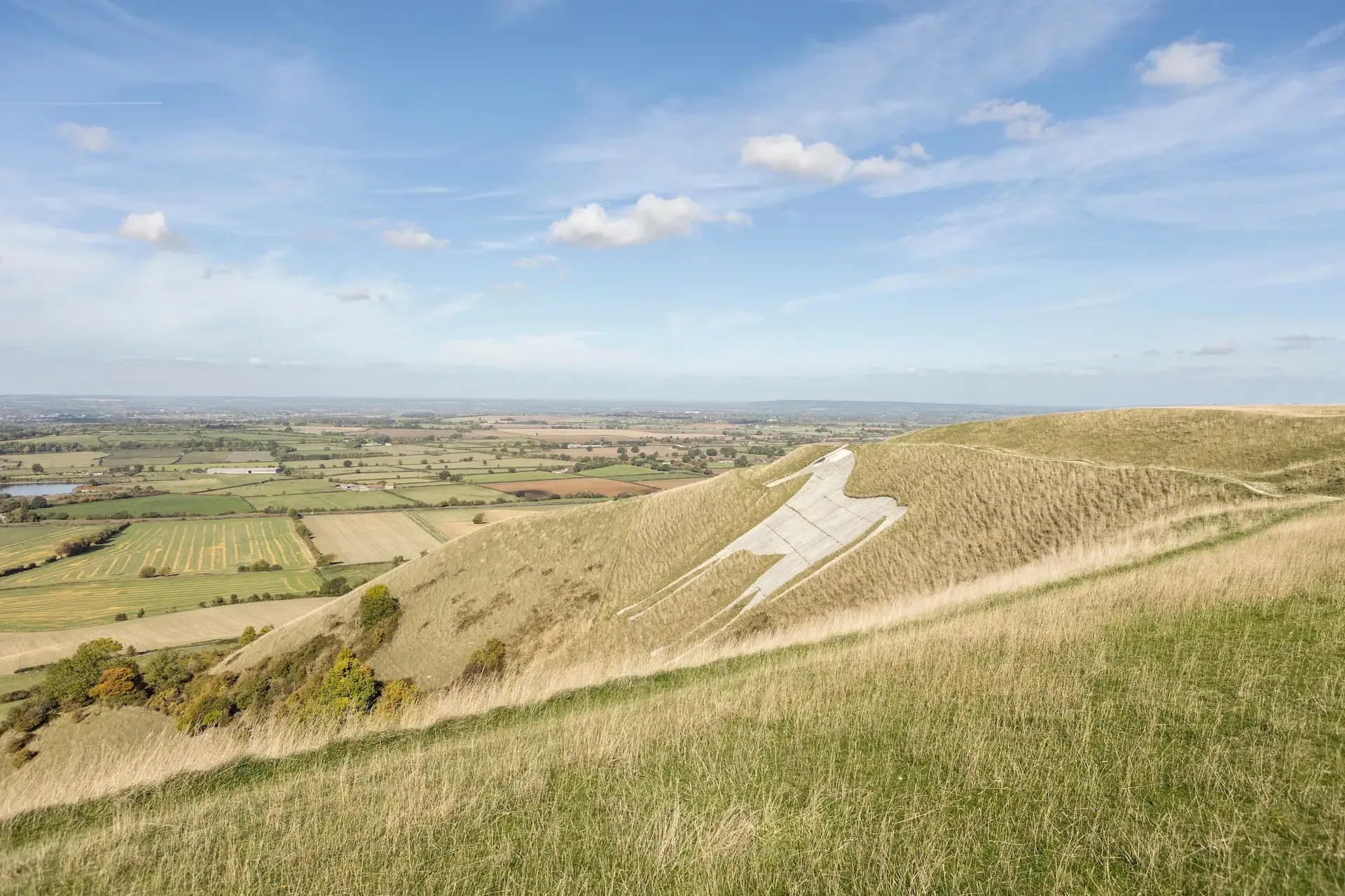
Wiltshire has taken a major step toward reversing nature loss, adopting one of England’s most advanced Local Nature Recovery Strategies (LNRS), powered by pioneering mapping and ecological modelling from innovative technology firm Map Impact.

The LNRS sets out a bold vision to restore and connect Wiltshire’s landscapes, ranging from world-famous chalk grasslands and ancient woodlands to fragile chalk streams, by identifying where nature recovery actions will have the greatest impact.

Map Impact supported Wiltshire Council by delivering a dynamic digital habitat map identifying corridors where restoring or enhancing natural habitats would most strengthen ecological connectivity. The model also simulates how different species might move through Wiltshire’s landscapes, helping planners and landowners target projects that make nature networks bigger, better and more joined-up. The resulting interactive map pinpoints priority areas for restoration and enhancement, helping landowners, farmers and planners to focus investment where it can deliver the biggest environmental gains.

“The Map Impact analysis has provided a clear visual explanation for everyone of what nature recovery and habitat connectivity across the landscape means,” said Alison Levy, Wiltshire LNRS Lead. “For the first time, we can visualise where action will truly make a difference, whether it’s connecting woodland corridors, restoring chalk grassland, or protecting our unique river systems.”

The interactive mapping tool also played a key role in public consultation and stakeholder engagement, allowing communities, conservation groups, and land managers to explore local priorities and contribute directly to the strategy.

Map Impact’s work ensures the Wiltshire LNRS remains a living strategy, capable of guiding Biodiversity Net Gain (BNG) investments, shaping local planning policy, and attracting green finance.

“Wiltshire’s LNRS shows what’s possible when data, technology and collaboration come together for nature,” said Nina Moiseeva, Map Impact’s Chief Scientist. “It’s a model that can help other counties accelerate their recovery plans and deliver real, measurable outcomes for biodiversity.”

With the LNRS now approved and guiding decisions across the county, Wiltshire stands at the forefront of England’s Nature Recovery Network, demonstrating how digital innovation and partnership can turn ambition into action.

Read our case study

The interactive LNRS map can be viewed here.

About Map Impact:

Map Impact believes that nature can be improved in harmony with human activity. By applying satellite data, their products deliver objective information about the performance of natural assets anywhere in the world. They are helping nature count through pioneering screening and monitoring products, combining novel technology with a highly collaborative approach to business.

Through partnerships, Map Impact are expanding the reach of their products to new audiences and filling data gaps that support a sustainable future.

Map Impact and Bluesky International announce strategic Reseller Partnership

Map Impact, the pioneering biodiversity and climate risk data provider, is excited to announce a new strategic reseller partnership with Bluesky International, the UK’s leading aerial survey provider. Together, they will enable the public and private sectors to use Map Impacts’ high-resolution, property-specific biodiversity insights and geospatial climate risk data products to support resilience, mitigation, and adaptation strategies.

Nature recovery and climate risk perils are increasingly important in strategic property asset and land management. As the impact of climate change on asset value starts to be understood, it’s crucial to understand how external environmental factors, increasingly impacted by climate change, can affect not only nature and people but also profit.

Bluesky, through its online Mapshop, will be the first to offer direct access to the Map Impact data for areas of interest specified by the customer. Bluesky will also provide the Map Impact data directly to customers on request for specific projects aligned with their other highly popular data services, delivering valuable insights for new and existing customers.

In reference to this announcement, Steve Keohane, Chief Commercial Officer from Map Impact, commented, “Bluesky is a well-loved and recognised leader in providing high-quality and accurate geospatial data that can inform decisions, shape policy, and provide detailed analytical insight. As our data is specifically designed to support decisions aligned to property-specific decisions for resilience, mitigation, and adaptation strategies, it felt like a natural fit.”

Both companies share the mission to enable the public and private sectors to work efficiently and cost-effectively, with access to the best available data and insights to support the key decisions necessary to meet a rapidly changing world.

Ralph Coleman, CCO of Bluesky, commented, “We see the addition of Map Impacts’ BiodiversityView and Climate Data services as delivering real value to both our existing customers and for supporting new customers with insights that may have been challenging to access before now.

Our customer base spans both the public and private sectors, and within this, there is a wide range of sectors which will benefit from this additional product offering.”

The data will be available online at Bluesky’s Mapshop in the coming month or via the Bluesky sales team.


Notes for Media:

Map Impact empowers understanding climate risk and biodiversity by applying satellite earth observation data. We are the UK market leader in national high-resolution, property-specific, biodiversity insights and geospatial climate risk data products to support resilience, mitigation, and adaptation strategies.

Our BiodiversityView product fulfils the UK Biodiversity Evidence Requirements with instant, on-demand access to biodiversity scores aligning with the legally mandated DEFRA Calculator. It is available anywhere in Great Britain and uniquely has a condition score for every land parcel with an annual update. Used by legal professionals, BiodiversityView underpins our climate risk data, which uses Earth Observations to deliver on three critical areas:

  • Wildfire risk, including data on urban-wildland interfaces
  • Drought stress, for planning, landscape resilience, and urban greening
  • Heat stress, for analysis for urban heat and vulnerable housing stock

UK expertise: We have leading Earth Observation scientists of global standing and a board experienced across the space domain, including advisory roles for the UK government. Our board is highly experienced in creating successful products that meet end-user needs across markets, creating repeatable revenue sources.

Link(s) to more: Map Impact | Advanced Geospatial Analytics & Solutions

Contact: Donna Lyndsay dl@mapimoact.io /Richard Flemmings Rf@mapimpact.io

Map Impact announce strategic alliance with ODCGIS

Map Impact, the pioneering environmental services data provider, is excited to announce a new reseller partnership with Oxford Data Consultancy (ODCGIS). Working together, they will provide Geographic Information Systems (GIS) data services for Housing Associations. Their collaboration will focus on identifying biodiversity metrics and assessing climatic risks using objective evidence.

Nature recovery and heat stress are becoming increasingly important in strategic property asset management for Housing Associations. It’s crucial to understand how external environmental factors, increasingly impacted by climate change, can affect properties and the health and wellbeing of their residents.

ODCGIS offers a variety of flexible packages to meet the needs of any Housing Association through managed GIS services. By incorporating Map Impact’s HeatView and BiodiversityView datasets, ODCGIS aims to augment its current offerings and deliver valuable insights for both new and existing customers.

In reference to this announcement, Steve Keohane from Map Impact commented “ODCGIS has a very strong and well-established presence in the Housing Association sector and makes the ideal reseller partner for us. Through our partnership, HeatView and BiodiversityView will be fully integrated into the Housing Association ecosystem.

Rick Thompson, Operations Director of ODCGIS adds “We are a one-stop-shop for Housing Association GIS and data provision and our clients recognise the growing difficulties brought about by climate change. Managing extreme heat is important for both properties and residents, and it’s essential to target vulnerable areas when implementing strategies like retrofitting or creating green spaces. These data sets from Map Impact provide detailed outputs that will aid decision-makers, and we are thrilled to include them in our range of data services.

Map Impact has launched HeatView

Map Impact, the pioneering environmental services data provider, has today announced the launch of its new HeatView product to support climate risk management across the built environment.

The increasing cadence of heat waves from our changing climate poses a significant risk to properties not suited to extreme temperatures. Later this year, a new Law Society advisory practice note will iterate the conveyancing process to include several new location-based factors relating to climate change, including heat stress. Using novel satellite analysis, Map Impact have provided an understanding of susceptibility to heat waves for every location in the country.

Through a collaboration with conveyancing search provider, Martello, HeatView will be integrated into environmental reports and become available as part of the property transaction process. The addition of HeatView’s nationwide dataset into Martello’s reports will precede these legal changes to position ourselves as a forerunner in the market.

Henry Crosby, CEO of Martello, commented: “We’re continuing to disrupt the environmental conveyancing reporting market. Inclusion of Map Impact’s HeatView has allowed us to further enhance our reports by being first to market with a local level score indicating susceptibility to heat waves.

This legal obligation runs in parallel to property industry representatives working towards their net zero strategies. There is an intrinsic link between meeting 2050 Net Zero commitments and confronting strategic heat mitigation in urban areas. These strategies are reliant on retrospective urban planning that prioritises green spaces to naturally offset the urban heat island effect.

Richard Flemmings, CEO of Map Impact, said: “We’re delighted to be launching a new product which focuses on providing evidence based reporting of climate risk. With increasing temperatures and heat wave events, it’s critical that the built environment sector has the tools available to understand and mitigate the risks associated with overheating. Launching HeatView and announcing Martello as an early adopter signifies our continued intent to bring innovative data services to market”.

This latest product development from Map Impact aligns with our overarching objective to empower decision-makers by helping nature count.

Map Impact merge with Digital Ecology

Map Impact, the pioneering environmental data services company, today announced their merger with Digital Ecology. This strategic move marks a significant milestone in Map Impact’s ongoing commitment to support monitoring and management of nature and the environment.

The merger is a clear sign of our shared commitment to advancing technology for the benefit of the environmental sector, greatly advancing our goal of simplifying the accessibility of affordable metrics to tackle an ever-growing demand for environmental data.

Traditional ecology relies heavily on fieldwork to provide actionable insights. However, there is a shortage of ecologists to meet the increasing demands of enhanced environmental legislation. In England, recent Biodiversity Net Gain (BNG) legislation has added pressure on landowners, property developers, and local authorities to assess biodiversity at an unprecedented scale. Improving efficiency through technology adoption and delivery is critical – which will be greatly strengthened through the combination of the Map Impact and Digital Ecology Teams.

Announcing the merger, CEO of Map Impact, Richard Flemmings said: “I’m delighted that the Digital Ecology Team are becoming part of the Map Impact family. This is a pivotal moment in our growth story, allowing us to greatly enhance our flagship product, BiodiversityView, and deliver a broad range of additional complementary ecological monitoring solutions. At the heart of our ethos is collaboration and the realisation that organisations must come together to tackle the urgent nature crisis – this merger significantly strengthens our ability to support all stakeholders in helping nature count.

Dan Carpenter, Director of Digital Ecology, added: “We have been working closely with Map Impact for over a year and the synergies between our organisations made them an obvious fit for us to continue to support our customers as we strive to integrate digital technology into their day-to-day business. By combining our strengths and expertise, we are well positioned to realise our vision of delivering integrated biodiversity monitoring, that is rigorous and cost effective.

Both companies will continue to operate independently but will build on their success to further positive collaboration as a fully-fledged partnership. In unison, Map impact and Digital Ecology are armed with the resources to manage the ever-growing requirement for consistent environmental insights.

About Map Impact:

Map Impact believes that nature can be improved in harmony with human activity. By applying satellite data, their products deliver objective information about the performance of natural assets anywhere in the world. They are helping nature count through pioneering screening and monitoring products, combining novel technology with a highly collaborative approach to business.

Through partnerships, Map Impact are expanding the reach of their products to new audiences and filling data gaps that support a sustainable future.

About Digital Ecology:

Digital Ecology harnesses the power of digital technologies to help ecologists and environmental scientists collect, manage, analyse and share data. Driven by a passion for both the natural world and cutting-edge digital solutions, we demonstrate the transformative potential of digital tools to elevate your work. By embracing open-source digital technologies, we aim to empower all environmental scientists to work smarter, more efficiently, and with greater impact.

New partnership with Healthy Homes Hub

Map Impact, the pioneering environmental data services provider, are delighted to announce a partnership with Healthy Homes Hub to support innovative technology delivery into the social housing sector. Alongside their current offerings this includes expansion to provide insightful heat stress data to help counter the increasing risk to human health from the Urban Heat Island effect.

Climate change risk is increasingly being considered as part of property asset management strategies. There is a need to understand not only the property itself, but also the surrounding neighbourhood, which Bristol-based Map Impact can deliver through the innovative use of satellite derived data analysis.

Announcing the Partnership Richard Flemmings, CEO of Map Impact commented: “Climate change is causing a range of new risk factors to be considered within the UK property sector, which have previously not been felt. Our novel data products allow customers to gain affordable, wide-area understanding of the risks associated with rising temperatures. We’re delighted to be partnering with Healthy Homes Hub to take these products to Housing Associations to support strategy development and mitigation”.

Jenny Danson, Founder of Healthy Homes Hub, said: “We are dedicated to improving the condition of housing, supporting net-zero strategy and making every home healthy. We share Map Impact’s deeply engrained ethos of collaboration, which is why we’re excited to be partnering with them to bring their neighbourhood and place-based perspectives to our community of stakeholders”

Much of the aging housing stock in the UK is not suitable for extreme heat, posing a significant health risk. The increasing frequency and intensity of heatwaves is challenging stakeholders to take action and initiate mitigation measures.

One of these stakeholders is Tony Cahill, Executive Director of Property at Livv Housing Group. He has taken a proactive approach to this growing problem by actively seeking to identify problem areas across his property portfolio in the Knowsley and Liverpool City Region. Mr Cahill developed a strategy encompassing climate hazard analysis which was greatly enhanced with additional insights from Map Impact.

“Climate change is here and we need to act now. The insights relating to heat risk delivered by Map Impact provide a critical component of a climate modelled future ensuring the right strategic asset management decisions will be made to support Livv Housing Group’s mission to provide net zero homes that work for all.” – Tony Cahill, Executive Director of Property, Livv Housing Group.

AGI Environment and Sustainability Award Winner

Map Impact, the pioneering environmental data provider, has won the Association for Geographic (AGI) Award for Environment and Sustainability. Sabbir Delowar, the technical lead for the Windermere Catchment Analysis project, accepted the award at a ceremony held as part of the 2024 Geo Business event in London.     

The prestigious awards have been reintroduced for 2024 to recognise excellence within the geospatial community with other winners including projects and individuals from Ramboll, Ordnance Survey and WorldPop. 

The innovative Map Impact project, completed in Spring 2024, provided valuable insights into the changing water quality in Windermere, England’s largest lake. By utilising satellite technology and anonymised mobile phone data, the analysis highlighted concerns about deteriorating water quality, garnering attention from local community interest companies (CICs) and national media.  

After accepting the Award from Lauren Holland of Hexagon Geosystems, Sabbir summarised the project’s findings at the event, emphasising the increased need for accountability in the water management sector. You can read more about the project, including methods and results, here. 

Challenging Lake Windermere’s water quality

Map Impact the pioneering environmental data services company has published its findings from the UK Space Agency Climate Call backed project, which studied the factors impacting the freshwater quality in Lake Windermere using satellite technology.

The strongest impacts on the Lake’s water quality came from increased levels of human movement in the catchment area creating over capacity issues for local wastewater infrastructure, and higher temperatures from weather and climate conditions. Both lead to increased chlorophyll and algal bloom events that significantly harm the Lake’s ecosystem. Agricultural activity and land use were not found to be a major contributor to spikes in algae within the Lake.

The project commenced in September 2023 and ran for six months, drawing on knowledge from local community stakeholder groups, and historic data as well as records from various organisations. Satellite imagery and derived data, covering the entire Lake Windermere catchment area, were analysed to provide fresh insight on the algal blooms, caused by increased nutrient input, and regularly seen in the Lake during the peak tourist season.

Richard Flemmings, Map Impact CEO, commented “By taking a novel catchment wide perspective we have been able to bring new evidence to support increased understanding of Lake Windermere’s condition. We’re proud to be able to openly publish the results of this study, including limitations, for use by anyone in the community.”

Dr Paul Bate, Chief Executive of the UK Space Agency, said: “The UK has a long history of expertise and innovation in Earth observation, developing satellites to collect increasingly detailed data and using that information to build services that help protect our planet.”

“Map Impact’s report, focusing on one of the UK’s most iconic and important lakes, demonstrates how these data can be used to give us clearer information about how the natural resources around us are changing, helping communities and decision-makers take tangible steps towards improving pollution levels and mitigating their impacts.”

Local campaign group Save Windermere has maintained a view that the inadequate local wastewater infrastructure was causing excessive nutrient input to the Lake and its spokesperson Matt Staniek commented on the findings “This isn’t just about visitor numbers or climate change; it’s about the failure of the Environment Agency and United Utilities to adequately manage and invest sufficiently in sewage infrastructure, essential for the lake’s resilience to these pressures.”

Historic bloom events were retrospectively studied using satellite images. These were correlated with other data sources; the Covid-19 lockdown periods provided an ideal control situation.  Travel restrictions limited human movement to the largely local resident population of c40,000 in the catchment area during the first period; the second period, where travel was allowed within the UK, saw some daily resident and tourist visitor figures peak at 320,000. These figures were sourced from detailed anonymised cell-phone data provided by a leading operator.

Algae growth is normally driven by a combination of climatic conditions and nutrient input, often flowing into the water from wastewater discharge and agricultural runoff. Therefore, in addition to metrological and human movement data, catchment land cover and land use was also studied within the project.

Full details of the study can be found on the following link: https://www.mapimpact.io/project/windermere-catchment-analysis/


Map Impact invited to deliver RICS training webinar

Map Impact has been invited to inform Royal Institute of Chartered Surveyors (RICS) members on how a well-executed Local Nature Recovery Strategy (LNRS) will be at the forefront of protecting the UK’s natural ecosystems. The consequence of environmental decline lifts the urgency for local authorities, environmental organisations, policymakers, and stakeholders to take action. 

Chris Burnett, COO of Map Impact, will detail how biodiversity conservation and ecological restoration hinges on understanding the intrinsic value of LNRS. The RICS audience will discover the background of this strategic approach, stakeholder engagement, and the impact of recent process updates. 

RICS are the globally recognised professional body at the forefront of supporting the management of the built and natural environment. Their approach is to work collaboratively to bring industry-leading knowledge to their members.   

This collaboration positions Map Impact as a driver for change across land management by capturing insights into biodiversity and acting accordingly. Map Impact’s BiodiversityView provides decision-makers with derived metrics for LNRS and the wider Biodiversity Net Gain (BNG) community. 

The webinar is open to members and non-members with registration at the following link: 

https://www.rics.org/training-events/online-training/scheduled/rics-uk-defra-statutory-guidance-on-local-nature-recovery-strategies-webinar 

‘Helping Nature Count’ Campaign Launches

Map Impact, the pioneering environmental data products provider, has launched the campaign ‘Helping Nature Count’ with a focussed offer to England’s Local Authorities. The Bristol based business recently announced the launch of its innovative BiodiversityView product, which provides remote, on-demand and consistent coverage of land habitats and their prevailing conditions across the whole country. This approach supports the wide range of environmental protection and restoration initiatives that Local Authorities have been mandated to oversee, co-ordinate, and enforce. These activities are often underpinned by performance targets and require monitoring into the future to manage progress.

In acknowledging the crucial role that Local Authorities undertake, Map Impact has focussed on two immediate areas of support – Local Nature Recovery Strategy (LNRS) and Biodiversity Net Gain (BNG) – where BiodiversityView can provide valuable insight and information to decision makers involved in these processes at local and regional level. An attractive launch offer has been created for the 48 responsible body authorities who are crafting LNRS strategies, alongside a further offer for Local Authorities seeking BNG baseline site condition assessments.

Commenting on the ‘Helping Nature Count’ campaign launch Richard Flemmings, CEO Map Impact, said “We recognised the need for a national holistic approach to achieve a consistent understanding of habitat condition. In developing BiodiversityView we have assessed every 50 metres of land habitat across England.  Whilst initial demand will come from English Local Authorities, the devolved Governments will require similar outputs and we are ready to support them.” 

Steve Keohane, CCO Map Impact, commented “BiodiversityView will support many planned nature improvement projects where data and mapping information is required. However, we have recognised the specific short-term needs around LNRS and BNG, where Local Authorities have been challenged to have the necessary processes and outputs in place. BiodiversityView is available immediately and we have created specific commercial offers to encourage early use and break down barriers to adoption and access.” 

Local Nature Recovery Strategies – Free Webinar

We invite anyone involved in Local Nature Recovery Strategies to join us for this interactive, free event, including local authorities, local environmental record centres, government agencies, conservation organisations, landowners and ecologists. Tickets are available now.  Local Nature Recovery Strategies (LNRS) are the government’s spatial strategies for nature. From late 2024 LNRSs must be in place across England. They must be evidenced-based, mapping the best locations to create, enhance and restore nature. LNRSs must identify and bring together a partnership group to align multiple nature-based projects and initiatives (the Nature Recovery Network). The collaborative approach will provide a means for consistent communication of local priorities, and efficient use of time and resources to ensure actions are completed. It will cover: Challenges in compiling holistic nature-based strategies; How to consider a consistent approach; Limitations of currently available historical data; New data sources that are available, and how they can be applied. With a fast-approaching deadline for publishing LNRSs across England, there is a need to find rapid solutions to understand the state of nature across regions. Knowledge of the baseline will allow targeted and consistent interventions and management into the future. The webinar will be recorded and those booked will receive a link to the recording.